Water. A resource so valuable in California, guidelines for its use had to be included in the state’s Constitution. Article X of the California Constitution establishes the ‘reasonable and beneficial use’ clause, and is the focus of pivotal water rights lawsuits in the modern era which ask, “what are reasonable and beneficial uses of water?”
The clause exists because water in California is always scarce in the summer and autumn and on occasion, widely abundant in the winter. The state realized that it needed to control the water it received in order to maintain the general welfare of its citizens. Several droughts led to the addition of Article X, notably the droughts of the 1950s, which spurred the State Water Project (SWP), and the 1976-77 drought, which was the year Article X was added to the state Constitution.
California faces two major kinds of drought. The first is conventional year-to-year drought brought on by dry climate conditions and to which most Californian’s are accustomed to. These droughts are simply the result of not getting enough rain and snow throughout the year. In the last 20 years, California has had to proclaim statewide emergencies twice as a response to drought [1]. One of these was the multiyear drought from 2011 to 2016, hypothesized to be most severe drought in 1200 years [1]. According to the US Drought Monitor, in 2014 58.5% of California was classified as experiencing ‘exceptional drought’ characterized by ‘widespread crop/pasture loss and shortages of water, creating water emergencies’. Hotter summer temperatures in these dry years will inevitably produce worse descriptions of years to come. Historically, droughts in California are correlated with neutral and La Niña conditions, which produce below average wintertime rain and snowfall, and are alleviated by rainy El Niño winters that eventually follow. However, drought could result from a change in the hydrological cycle of California, even in rainy El Niño winters.
The second kind of drought is a product of atmospheric temperature in the Sierra Nevadas (SN) and California’s ability to store water. Rising temperatures would result in two things. First, higher wintertime temperature would minimize the formation of a snowpack in the SN, which holds between 1/3 and 2/3 of California’s freshwater in any given year [2,3]. The elimination of this historical storage system would leave California without a consistent delivery of water during critical agricultural summer and fall months, when rain is most scarce.
The second, higher springtime temperatures, would shift the delivery of water from melting snow far earlier in the year [3]. Instead of the delivery starting in April and lasting until October, it could start in February and end in August, leaving the driest months of the year, August through October, with no delivery of water. This is particularly problematic in years where California’s snowfall is naturally depleted due to La Niña conditions. Sprawling metropolitan areas, like the LA basin and San Francisco bay, would likely face future humanitarian crises, due to their growth ultimately relying on water from the SN [3]. One step that the state of California could take to reduce the likelihood of humanitarian crises during El Niño years is to invest in better infrastructure for storing and delivering water. The main issue is that in a future with higher rain-to-snow precipitation, much of the freshwater will quickly rush through the river valleys straight into the ocean. The ability to control this rush of water would be invaluable. Until this control is designed and implemented, smaller SN snowpacks, higher snow-to-rain precipitation, and earlier melting of snow, due to rising temperatures, would not only leave California in droughts during the height of its summers, it would also lead to extensive spring and early summer flooding [2].
The SN snowpack is an important buffer against flooding in California’s Central Valley; the flooding has only been tamed for little over a century and a half. Not so long ago, the winter of 1862 brought early and late rains and the state’s capitol flooded; similar events took place in 1878. Despite our technological advances, namely the engineering involved in the SWP, we still are seeing infrastructure fail. Just some years ago, in 2017, the Oroville Dam in California, the tallest dam in the US, was damaged by heavy rain and SWP decisions led to further damage to the integrity of Lake Oroville [4]. Although the dam was designed to withstand larger storm events, 180,000 people were evacuated in preparation for a catastrophic failure of the dam and downstream infrastructure [4]. It is important to note that the SN snowpack nearly broke records during this 2017 event. As climate change progresses and temperatures rise in the SN, more of this snowpack will fall as rain and more will melt earlier in the year contributing to the stress already placed on our dams by large storm events.
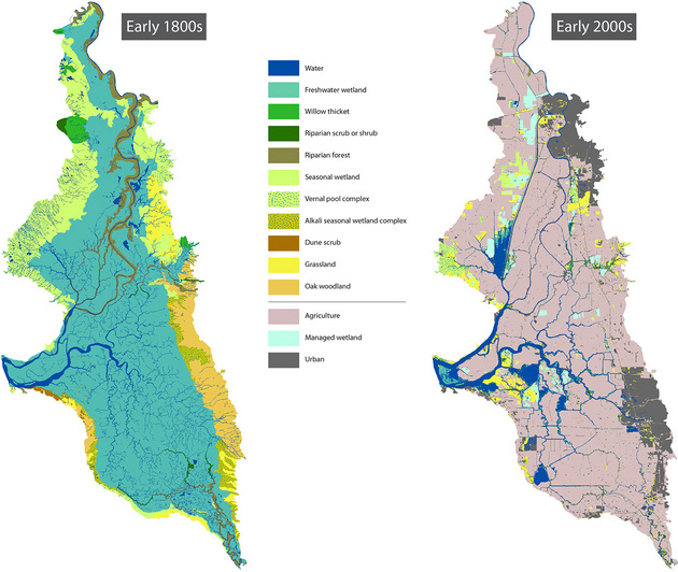
Not only are dams and reservoirs subject to failure in the face of high rainfall, the levees and dykes that organize the Bay Delta are as well. Throughout the Bay Delta, California faces a two-pronged flooding risk. The first originates from the mountains and is the result of changes in the hydrological cycle that were previously discussed. The second originates from sea level rise. The purpose of this 1,600-mile-long levee system is to prevent flooding, such that the water flowing through the delta is manageable and the land ‘saved’ from being a wetland can be used for agriculture. These levees were engineered in the 1930s without guidance from modern, sophisticated modeling and engineering or even the thought of climate change. These levees have weak points and a track record of failing each year in isolated events [5]. These isolated events are products of poor engineering, and the consequences pale in contrast to failures due to earthquakes and flooding.
A large portion of this levee system lies on top of an active tectonic fault and a 6.7-magnitude earthquake, something the U.S. Geological Survey predicts has a greater than 99% chance of occurring in the next 30 years, could compromise the integrity of the levee system in 20 locations simultaneously [5]. Failure would occur at more than 50 locations simultaneously as result of flooding, which the U.S. Army Corp of Engineers predicts has a 99% chance of occurring in the next 50 years as a result of sea level rise and increased rainfall [5]. The California Department of Water Resources estimates that a 1-foot rise in sea level will turn 100-year peak tide events into 10-year peak tide events further increasing flood risks. According to the 2017 update of the Central Valley Flood Protection Plan approximately 150 miles of urban levees do not meet current engineering design criteria for flooding and 740 miles of non-urban levees have a high potential for failure during flood events.
To make matters worse, each year that the valuable peat soils of the Bay Delta are consumed by agriculture, the topsoil compacts and is removed inch-by-inch. This gradual decrease in elevation is compounded by over-extraction of groundwater throughout the Central Valley. Currently, the dry land in the delta lies far below sea level, effectively making this levee system a 1,600-mile-long dam. The moment this dam fails, inhabitants of the Central Valley would be inundated, homes would be swept away, and the valley would be devastated. An estimate put out by the Central Valley Flood Protection Plan (2017) for the fiscal risk due to flooding and levee failure is around $80 billion dollars.
If it is not blatantly clear yet, California has a lot to address as it relates to water resources. Climate change is affecting nearly every aspect of water resource management on two distinct fronts: sea level rise and rising temperatures. California’s future begs and pleads for a revision of water resource management and planning to provide for the general welfare of all Californians. The terms ‘reasonable’ and ‘beneficial’ must become better defined in the face of droughts and in the face of flooding, our infrastructure must stand strong.
References:
- Tortajada, C., Kastner, M. J., Buurman, J., & Biswas, A. K. (2017). The California drought: Coping responses and resilience building. Environmental Science & Policy, 78, 97–113. https://doi.org/10.1016/j.envsci.2017.09.012
- Huang, X., Hall, A. D., & Berg, N. (2018). Anthropogenic Warming Impacts on Today’s Sierra Nevada Snowpack and Flood Risk: Warming Impacts on Snowpack and Floodrisk. Geophysical Research Letters, 45(12), 6215–6222. https://doi.org/10.1029/2018GL077432
- Sun, F., Berg, N., Hall, A., Schwartz, M., & Walton, D. (2019). Understanding End‐of‐Century Snowpack Changes Over California’s Sierra Nevada. Geophysical Research Letters, 46(2), 933–943. https://doi.org/10.1029/2018GL080362
- Koskinas, A., Tegos, A., Tsira, P., Dimitriadis, P., Iliopoulou, T., Papanicolaou, P., et al. (2019). Insights into the Oroville Dam 2017 Spillway Incident. Geosciences, 9(1), 37. https://doi.org/10.3390/geosciences9010037
- Port, P. S., & Hoover, S. A. (2011). Anticipating California Levee Failure: The State of the Delta Levees and Government Preparation and Response Strategies for Protecting Natural Resources from Freshwater Oil Spills. International Oil Spill Conference Proceedings, 2011(1), abs112. https://doi.org/10.7901/2169-3358-2011-1-112
